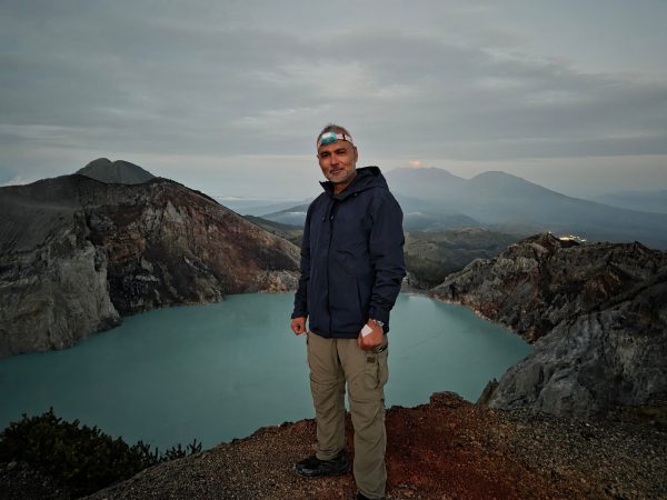
Most people who climb Kawah Ijen, Kawah in Bahasa and Malay meaning simply crater, come for the blue fire or the turquoise water. Both justify the climb. Neither is the most significant feature here. I stood at the rim and found myself momentarily unable to take it in. I closed my eyes for a moment and tried to picture what had once stood here, the mountain that must have risen before this hollow existed, and the force required to erase it. What held my attention was not only the lake, nor the flames that move across in the dark. It is the realisation that all of this rests within a caldera twenty kilometres across, a void where a volcano once stood. And behind it, a story written over tens of thousands of years, of growth, collapse, and return.
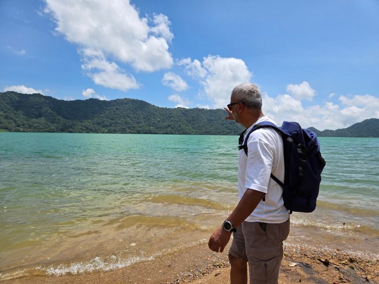
I was at Ijen last month in March. I hurt my ankle on the descent and spent two days unable to walk properly, sitting with the view and rather more time than planned to think about what I was looking at. I had promised to write this properly. Here it is.
To understand Ijen, you have to go back much further than the lake. You have to go back to a mountain that no longer exists.

Around 300,000 years ago, a large stratovolcano began accumulating in the easternmost corner of Java. The Indo-Australian Plate was grinding beneath the Eurasian Plate at roughly seven centimetres a year, generating the heat and partial melting that has been driving volcanism along the Sunda Arc for far longer than anything has been recording it. What grew over tens of thousands of years was a structure geologists now call Old Ijen, a mountain that may have reached around 3,500 metres, built from successive eruptions of andesitic and dacitic lava and pyroclastic material, each cycle adding to the edifice, each dormant interval allowing the flanks to consolidate. Then, sometime before 50,000 years ago, the ground gave way.
A series of catastrophic eruptions evacuated the magma chamber so rapidly that the overlying structure lost its support and collapsed. The volume of material ejected runs to tens of cubic kilometres, though the precise figure remains debated in the literature. What is not debated is the scale of the aftermath. Pyroclastic flows buried the surrounding landscape in places hundreds of metres deep. When it was over, a caldera remained, an elliptical depression roughly 20 kilometres across, enclosing approximately 210 square kilometres of collapsed ground. The northern rim is still visible today as a curved ridge on the horizon. Elsewhere, the walls were gradually buried by what came next. Because the ground did not stay empty.

Over the past 50,000 years, approximately 22 new volcanic cones have grown inside and along the rim of the caldera, each one building on the material of the collapse. Gunung Merapi, the local one rather than the more famous peak in Central Java, forms the highest point of the complex today at 2,799 metres. Raung rises to the southwest at 3,332 metres. Smaller cones cluster along an east-west zone across the southern caldera floor, some extinct and deeply eroded, others preserving the geometry of more recent activity. The caldera floor between them has been colonised by coffee plantations and villages. Around 12,000 people live inside the depression which included my guide and driver. The soil they farm is extraordinarily fertile because it is composed of pulverised volcanic material from a catastrophic eruption they have no cultural memory of, and no reason to think about while they are harvesting coffee.
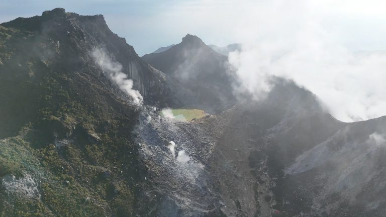
Kawah Ijen sits on the eastern side of the caldera, on the flank of the Merapi rim-volcano. It is the only cone in the complex currently showing sustained surface activity. Its crater measures roughly 950 by 600 metres and descends around 200 metres to the lake surface.
Approximately 30 million cubic metres of water. pH well below one, among the most extreme natural waters on Earth. Surface temperatures near active vent areas reaching 60 degrees Celsius. The turquoise colour comes from the combination of extreme acidity and dissolved metals, iron, aluminium, silica, and the chemical products of hydrothermal gases rising through vents on the lake floor and dissolving into the water column above them. The lake supports only limited life, restricted to specialised extremophiles adapted to chemistry that would be lethal to virtually everything else. The river that carries its controlled outflow, the Banyupahit, runs acidic along much of its course. A dam was built at the lake outlet in 1921 to manage the water level and reduce the risk of an uncontrolled release downstream. It remains in place.
On the shoreline, a cluster of solfataras vents sulphurous gas at temperatures exceeding 200 degrees Celsius. During the day you smell it long before you see the source. At night, under the right conditions, something happens here that has no real equivalent elsewhere. The gases ignite on contact with atmospheric oxygen and burn blue. Not the orange-red of combustion but a cold electric blue, running in rivulets where liquid sulphur catches alight before cooling and solidifying on the crater floor. The flames reach up to five metres. The miners who work these vents in darkness, breaking solidified sulphur with iron bars and loading it into baskets they will carry 200 metres up the crater wall, move through that blue light wearing cloth masks that provide only partial protection from gases that at sufficient concentration are lethal. They carry between 70 and 90 kilograms per load. They make one or two trips a day. They are paid by weight. It is among the most physically punishing labour practices still operating anywhere on Earth, conducted inside one of its most extraordinary geological features.
The recorded eruption history begins in 1796. The most consequential event in historical time came in 1817, when a larger eruption produced a mudflow that reached and destroyed villages in the Banyuwangi area below. That 1817 event was the last confirmed magmatic eruption at Kawah Ijen. What has followed since, in 1917, 1936, 1952, 1993, 1994, 1999, and into the 2000s, has been a sequence of phreatic eruptions driven by the superheating of groundwater rather than fresh magma breaching the surface. This is not a reassuring distinction. The 1917 event sent boiling water nine metres above the lake surface. In 1999 two explosions were audible two kilometres from the crater. In 2018 a sudden gas release sent 27 visitors to hospital.
The primary hazard at Kawah Ijen is the lake itself. Approximately 30 million cubic metres of hyperacidic water sitting in a crater above populated valleys represents a lahar scenario of serious consequence. In the event of a significant eruption or a failure of the crater wall, that volume would enter the drainage systems below at speed. The port cities to the north, with a combined population of around 1.5 million, lie near the mouth of the principal drainage from the caldera. The dam helps regulate this risk. It does not eliminate it.
In 2023 the Ijen complex received designation as a UNESCO Global Geopark, recognising the full landscape, not only the crater but the caldera floor, the ring of new volcanoes growing inside the ruins of the old one, the coffee cultivated on soils derived from a catastrophic eruption, and the communities that have settled inside a collapsed mountain and stayed.
Stand at the rim at dawn, with the lake below and the sulphur plume rising into cooling air and the turquoise water catching the first light, and what presents itself is not the product of a single event but of 300,000 years of accumulation, collapse, reconstruction, and persistence. Old Ijen fell. The caldera formed. The new volcanoes grew. The lake filled. The miners came. Somewhere beneath the lake floor, the process is still running.
Copyright © Tales from the Horizon, 2025